|
|
| Hiking | South Rim | West Rim | Boucher | Bright Angel | South Kaibab | Hermit | Grandview | New Hance |
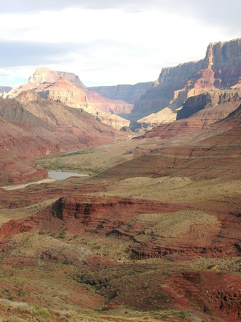
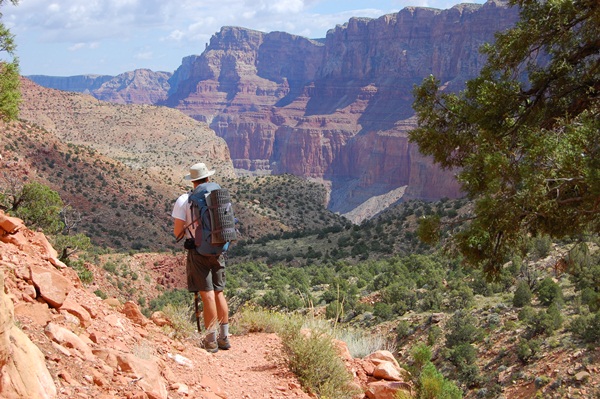
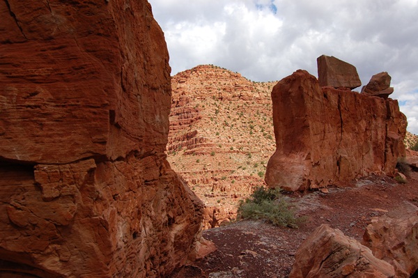
| The Tanner Trail is another of those well kept secrets that only hard core backpackers and hikers use. It's the easternmost official trail on the South Rim. The Tanner is considered Advanced, and it does have some rough spots, but it is certainly not as hard as the New Hance. It goes 10.4 miles down to some beautiful dunes and sand bars on the Colorado River, but of course you won't get that far on a day hike. Both the top right photo and the one here at right show the trail dropping toward the Tanner Creek Canyon. That's the Tanner to the left, a whitish trace visible once, then again much further down. |  |
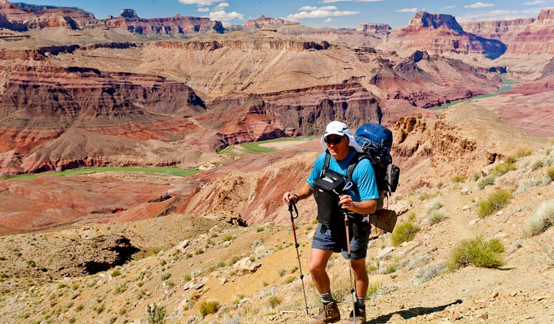 |
Like most of these trails, the Tanner was originally a game trail, then used by the Anasazi, Hopi, Havasupai and Navajo. In 1884 Seth Tanner rebuilt the trail to reach his Copper diggings along the Colorado River. All the people in these photos are backpackers we encountered on the trail. When we day hike, we carry much lighter packs. |
| The Tanner is generally recognized as the hottest trail in the Canyon. It has very little vegetation, zero water, and miles of reflecting light colored rock layers, so you are in effect hiking through a microwave oven. In June, July and August temperatures between noon and 3 pm average 120 degrees. This is the closest thing to pure desert hiking the Grand Canyon offers. Even the breezes which pick up in mid afternoon blow hot. Obviously, the time to hike the Tanner is April, May, October or November. No veteran hikers tackle it in Summer. |  |
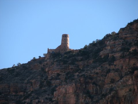 |
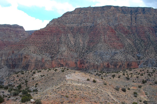
The entire time you're on the Tanner Trail the Sentinel Tower at Desert View will be looking down on you. The Anasazai had good reason to build the tower on that spot, now called Navajo Point. At 7438 ft. it was and still is the highest spot along the entire South Rim, and the tower itself is several hundred feet higher. (The North Rim is a thousand feet higher along its entire length). Lookouts could see every trail and side canyon between the river and the South Rim and out across what is now the Navajo Reservation. Anyone visiting the tower with a good pair of binoculars (and remember there are coin binoculars mounted on the railings) can watch your every move, including lunch and potty breaks. If you want privacy, you need to duck around behind any buttes or rock formations. If you can see the tower, they can see you. |
| This is the first major landmark along the Tanner Trail. It's a cleft in the rock looking down on the 75 Mile Creek Canyon. At this point on the trail you'll be on a narrow saddle between two major drainages : 75 Mile Canyon and Tanner Canyon. The precise point where we're taking this photo is 1.9 mile down. Many day hikers have lunch here and turn back. It takes most day hikers about an hour to get here and about two hours to return to the Rim, but we advise you to go further. Turning here would give you a 3.8 mile round trip and a good day, but you'll miss some spectacular scenery. |  |
 |
This is your second major stop at 2.7 miles down. The formation right next to the trail is Stegosaurus Rock. Behind it is Escalante Butte. Many energetic hikers come this far, then climb the butte and have lunch on top. The views from up there are great, and you can climb it without ropes, but there's no trail and you'll be scrambling most of the way up and sliding back down. A lot of day hikers turn around here for a 5.4 mile round trip. However, we still urge you to keep going. |
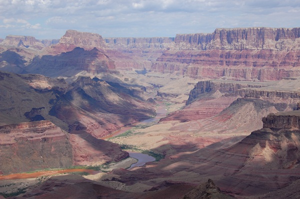
| This is the furthest you can descend on a day hike. You're looking at Cardenas Butte, named for Garcia Lopez de Cardenas, first lieutenant to Coronado. Acting as Coronado's proxy since the Conquistador's arm was injured in a battle against the Zunis, Cardenas and a small group of Spaniards descended the Old Hance Trail, visited the river, and climbed back out via what would become the Tanner Trail. They thus became the first Europeans to see the Colorado. The butte can be climbed without much trouble and the top makes for a great lunch stop. As with Escalante Butte, the views are wonderful. Turning here gives you a seven mile round trip. That's the Tanner Trail in the lower foreground of the photo. Even if you don't climb the butte, from the trail you can see the views below. At left you're looking back up at the South Rim. That bump in the center is the Sentinel Tower at Desert View. In the center you're looking eastward toward Comanche Point. It and that wall, called The Palisades, are the boundary of the national park and the Navajo Nation. At right you're looking northward along the river toward Marble Canyon. |  |
 |
 |
 |
Comment or
Question ?? Join us at The
Forum. |
Read our day to day adventures at the Blog |
Or contact us at trekkerforrest@aol.com |