| Route 66 | Cities | Beaches |
|
| Hiking | South Rim | West Rim | Boucher | Bright Angel | South Kaibab | Hermit | Grandview | Tanner |
| AFTER you've hiked the Bright Angel, South Kaibab, Hermit and Grandview trails, if you want to test yourself against the most challenging trail in the Grand Canyon, you can hike the New Hance. This trail will take you down into some of the least visited and most memorable scenery in the Canyon,, but it is a rugged, exhausting and sometimes punishing route. You have to have the right equipment, have some experience in hiking Grand Canyon trails, and have some orienteering and route finding skills. It's not overwhelming --- we see grade school kids with their parents on it all the time and they don't have any problems --- but it's not a hiking trail as much as a scranble. You don't have to do any actual rappelling, but you will be climbing down and then climbing back up some steep and rugged sections. | 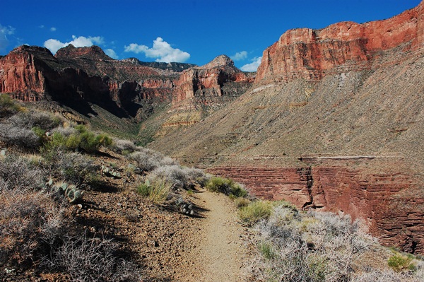 |
| The first challenge is actually getting on the trail. There is no parking available at the trailhead. It's just off East Rim Drive. You can park at Moran Point and hike a mile southwest, or park at Buggein Tank Forest Trail and hike half a mile northeast. The Buggein Tank trailhead offers shady parking, but be sure and don't block the forest trail in case Forest Service vehicles need to get into the Coconino National Forest. The photo at left shows where the trail goes in from East Rim Road, complete with No Parking sign. Notice there is no sign indicating this is the beginning of the New Hance Trail. That sign is further in. |
| This is the oddly placed New Hance Trail sign, five minutes in from East Rim Road. Since the New Hance Trail is so rugged, few day hikers bother with it. The rewards for all that hard work are the incredible scenery down below, getting to camp on the beach at the New Hance Rapids (the most challenging drops on the Colorado River), and access to the eastern section of the Tonto Trail. As a day hiker you can't get down that far. So most people don't bother with it. The few people you'll see will be carrying full packs and planning to spend two or three nights down in the Canyon. However, we think it is a great one day outing. You just have to approach it, not as a hike, but as a day of playing on the rocks in the heat. And even as far down as you're going to get, you'll have some incredible photographic opportunities. |
| The New Hance Trail is not all steep scrambling. There are some idyllic sections of fairly level walking across flower filled meadows, through pine forest, and boulder fields. But the trailbed is never smooth. You have to watch your step. Sprained ankles and nasty falls are always a threat, especially since the scenery continuously tempts you to look up from the trail and admire the richly colored rock formations. The New Hance demands concentration. |
| You start dropping immediately and the intensity picks up around every turn and switchback. The New Hance does not receive the frequent maintenance of the other trails. The trailbed is narrower, undergrowth presses in from the sides more aggressively, and downed trees and branches will force you to climb over, duck under and pick your way around. |
| The trail often inches its way around tight cliffs with dizzying dropoffs. The rocky, gravelly trailbed is treacherous. You have to step carefully and lean inward. Those with fear of heights will have major problems with the New Hance. You'll find yourself wondering out loud how in the world John Hance ever brought pack trains up and down this trail, no matter how sure footed mules are. |
| The Havasupai had used the original Red Canyon Trail for at least a thousand years before John Hance arrived in 1883, took it over, improved it, and used it to access his mines down along the river. The Havasupai had chipped hand and foot holds into the cliffs. Hance rigged up a rope system to lift and lower mules down the cliffs, an awkward strategy at best. In 1894, '96 and '97 major rockslides, cliff breakaways and flash floods along Red Creek buried and washed out that original Hance Trail. So Hance hired a surveyor and engineer from the Santa Fe to plan a whole new trail and spent a year building it. Opened in 1900, this became the New Hance Trail. He used it for both mining and tourist trips until bought out by the park service. Reports of the time suggest that, when new and continuously maintained, the trail was actually pretty good. When the park service took it over, however, they never considered it a major trail, and have never given it the maintenance it needs. Since 1980, when the park service budget was slashed, their neglect of the New Hance has been almost complete. It is now about 50 years overdue for a complete year long upgrade. | 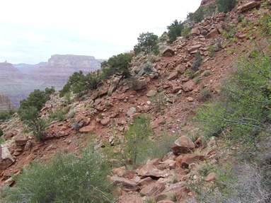 |
 |
Since so few people use the New Hance, the trailbed is not always obvious. In addition to picking your way across rock strewn hillsides, you will sometimes have to pick out the faint trace that is the trail. You can say this adds to the fun, but when you choose wrong and have to back up and try a new direction you'll find yourself wishing someone would win the lottery and donate money to the park service specifically to redo this trail. |
| There will never come a time when you have to actually rappell down any cliffs. But there are times when a good rope would come in handy, especially if you have kids along. We've brought several youth groups out here, and we always bring a good length of rope. With or without a rope, you have to step carefully. These rocks can tilt and slide, and you can sprain an ankle. This is no place for low top hiking boots, and especially no place for basketball shoes, keds or other casual footwear. You need strong ankle support. You should also have a sports strap on your sunglasses and if you wear a hat, it should have a strap, too. | 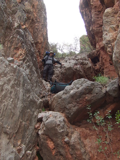 |
 |
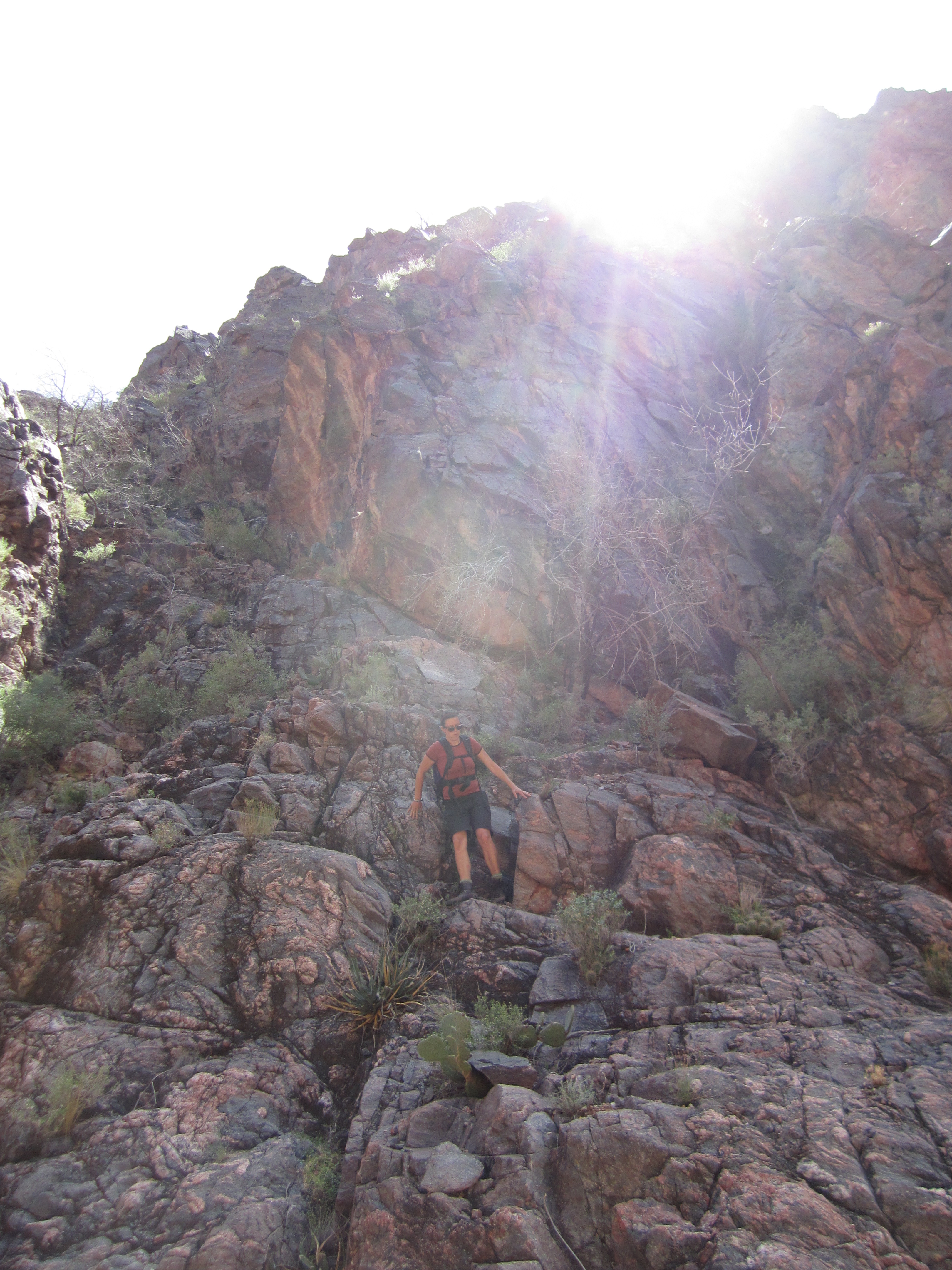
Look carefully and you'll see a person in this photo, halfway down. This is "The Chute," one of the more famous sections of the New Hance. 1900 accounts of the trail report that John Hance had built a series of tight switchbacks up this face, but they're long ago overgrown and eroded away. Now, it's just a scramble. |
| We've pulled way back to get this whole scene in one photo, but if you look carefully you can find four hikers climbing the slope. Places like this are in many ways easier to climb up than to come down, but they're slow going either way. | 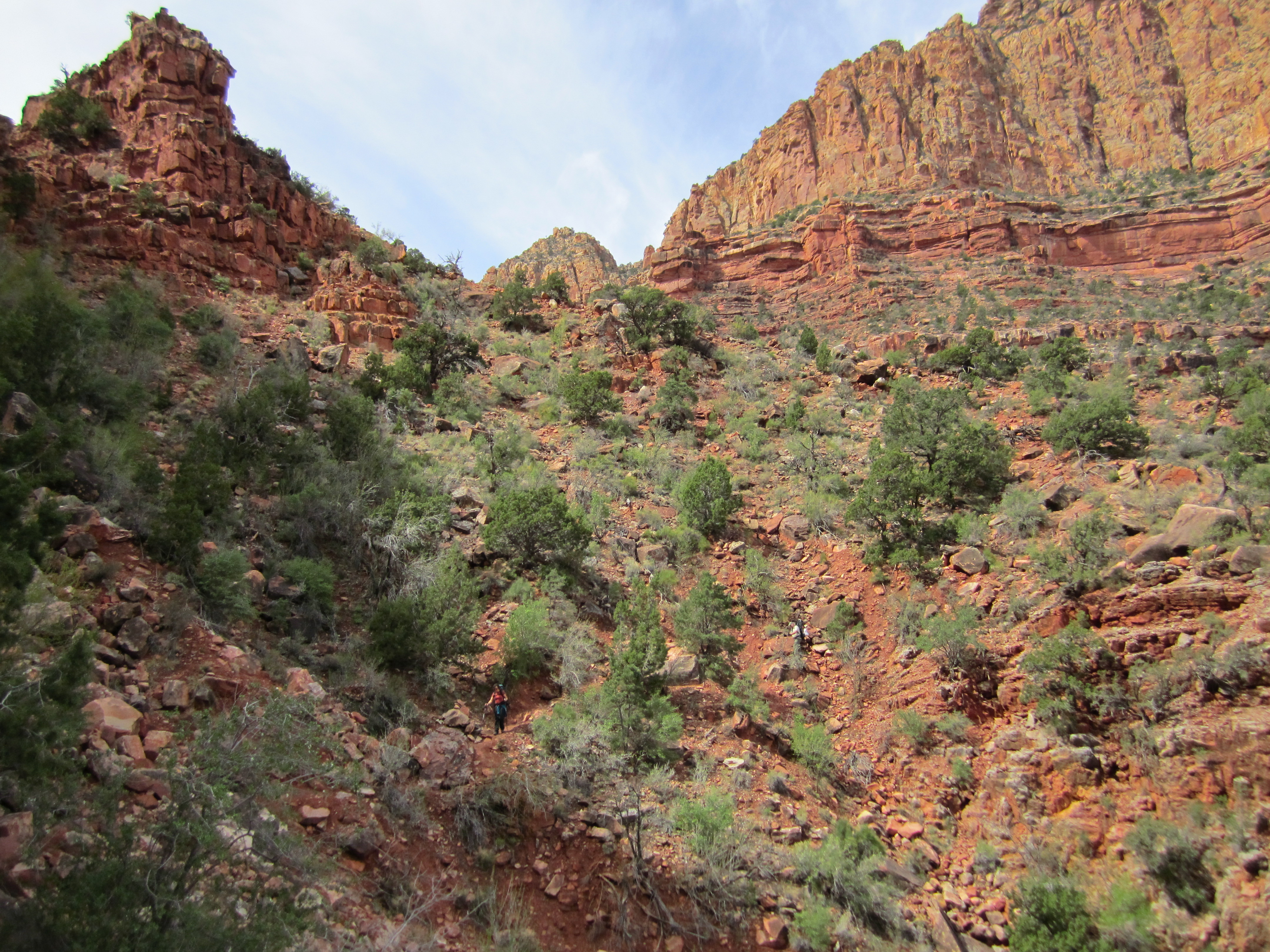 |
This is a photo of Coronado Butte, one of the great landmarks of the New Hance Trail. You'll start out even with it and gradually descend until you're at its base. Francisco de Vasquez Coronado was a Spanish Conquistador who led a 1540-42 expedition to explore what is now the American Southwest. Coronado reached the Hopi village of Tusayan and learned from the Hopi of the great river and canyon just a few miles north. Coronado, Lieutenant Garcia Lopez de Cardenas, and a small force were led by Hopi scouts to Zuni Point, two miles east of the New Hance trailhead. The Hopi tried to lead the Spanish down the old Red Canyon Trail (the "Old Hance Trail"). When they reached the cliffs which had to be descended by foot and hand holds, Coronado refused to go further. They obviously could not take horses and wagons down this route, so he was not interested. Cardenas later wrote that Coronado's arm had been injured in a battle against the Zunis three weeks earlier, so he was not able to descend the cliff. Coronado sent Cardenas and a small group down with the Hopi so they could actually reach the Colorado River, while Coronado remained on the Rim. These were the first white men to see the Grand Canyon and the Colorado. |
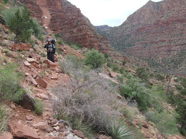
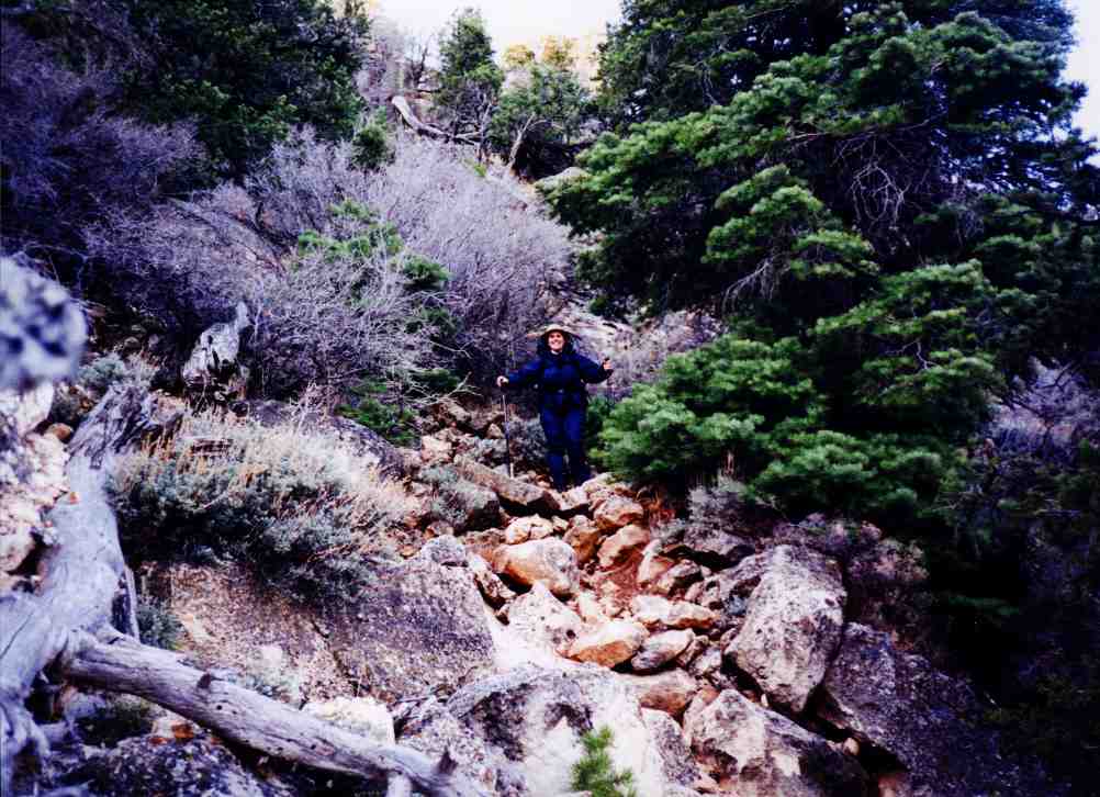
| We are always strong advocates of trekking poles, but we believe on the New Hance Trail they are essential. We have seen too many people sprain ankles here and we have seen a few people break ankles on this trail. On this unstable trail bed the two poles provide twice as much stability and can avert disaster. They can be used to test rocks before you put your weight on them, and they can help maintain balance. This photo is taken in early April so they're wearing fleece anoraks. You'll probably be wearing t shirts in June, July or August. But the long pants are still wise, and we recommend biking or canoeing gloves. You're going to be grabbing a lot of sharp rock edges. |  |
 |
As we did on other trails, we recommend you base your turnaround point not on a destination but on a time. We recommend leaving the trailhead at 9 a.m. and descending until noon. Then take a long lunch break and head back up. This will require some self discipline, because the further you descend into the Red Canyon the more spectacular the scenery. You will always be tempted to descend just another 30 minutes. Realize the trail all the way to the Colorado River is eight miles, and you cannot make that and back in one day. So no matter how far you go, you're going to feel disappointed turning around. Just accept the fact that if you want to get down to the river, you'll have to come back and do it as an overnight backpacking trip. With all of this in mind, there are two popular turnarounds. The first is at the Coronado Butte Overlook. This comes at the two mile point. Remember you're making slower progress than usual, and the two miles back up will be really strenuous. Coronado Butte Overlook is a spectacular lunch stop. So turning around at Coronado Butte Overlook might not be a bad idea. You'll have had a four mile round trip which will probably be the most strenuous day hike you've ever taken. However, if you think you can go further, the second common turnaround is at the head of Red Canyon. The photo below shows what you'll see as you descend to the canyon floor. If you go any further you're going to be working your way down the streambed, as the bottom two photos show. So stopping at the head of the Red Canyon means you keep your feet dry. Given the challenge of climbing back up to the Rim, if you come all the way to the head of the Red Canyon, you'll probably be getting back to your vehicle around dark. You will definitely be exhausted. |
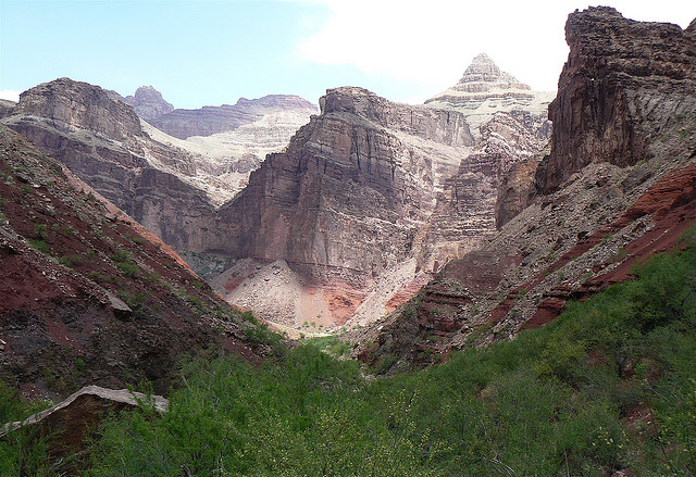
| As you descend into the Red Canyon, you'll be confronted by this scene. This is The Great Unconformity, a massive fault. In between that tilted red layer coming up from the right and the level Bright Angel Shale is a gap of half a billion years of geologic history. This scene is clearly visible from Moran Point up on the Rim, and telephoto photos of it are commonly used in texts on Geology or Earth Science. Anywhere in the Grand Canyon is a good place to study Geology, but the Red Canyon is one of the very best. |
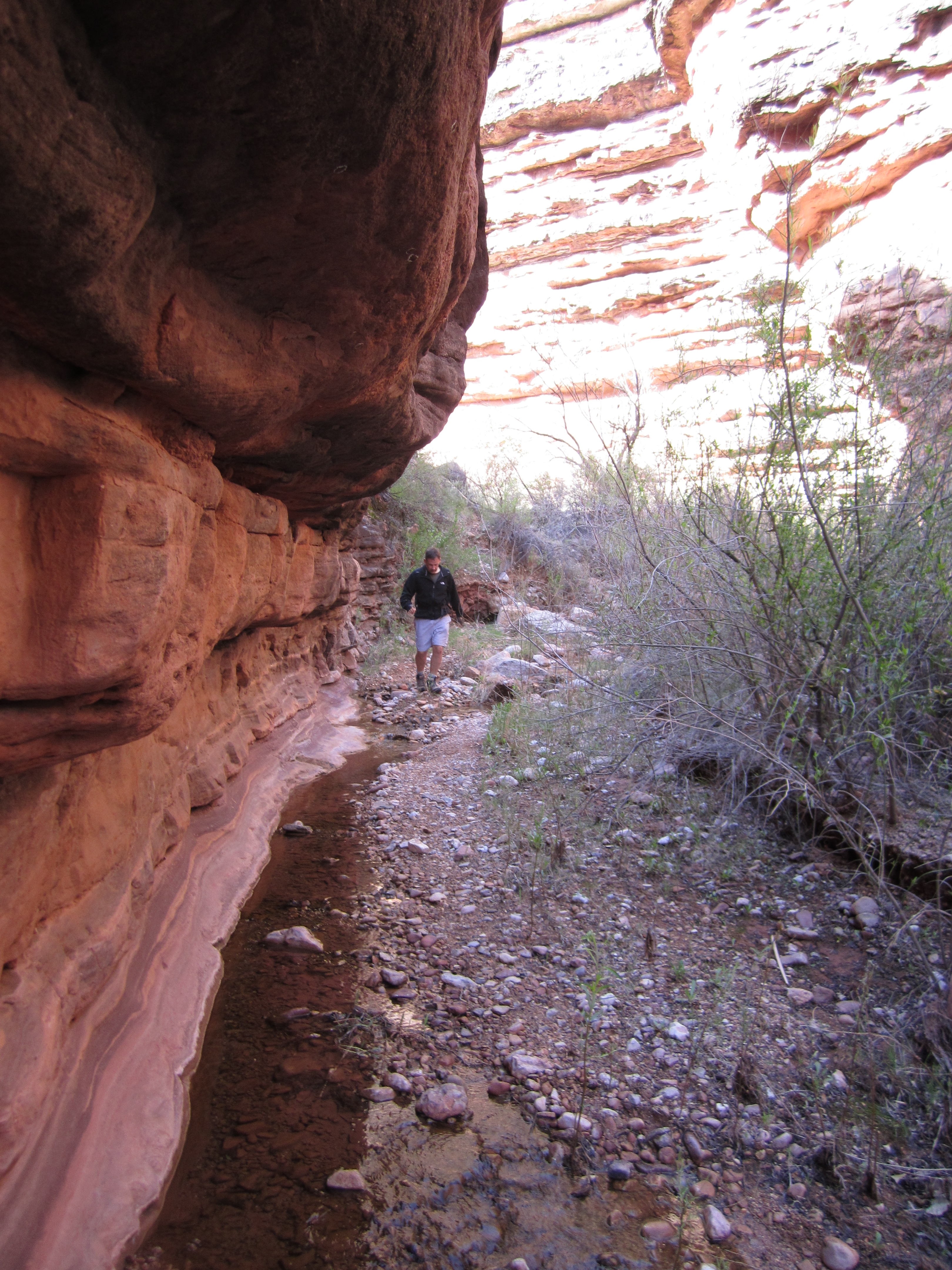 |
The trail basically merges with the streambed in Red Canyon. Occasionally, the trail climbs up and follows ledges around waterfalls or steep chutes, but you mostly find yourself just hiking down Red Creek. One advantage of this is you get to hike in cool, damp shade for a while. The slopes and rock faces on the way back up will be in bright sun. The Upper New Hance Trail averages 104 degrees in the afternoon in June, July and August. If you're down in here and it starts to rain, you need to Get Out Fast. RUN. With little soil or vegetation to absorb it or slow it down, water runs off the rock faces immediately and fills up a drainage like this within 10-15 minutes. Flash floods occur routinely in the Grand Canyon. In the Summer here late afternoon thunderstorms are common. |
| If you are absolutely determined to hike at least 30 minutes or so down the Red Canyon, you need to buy a pair of "river shoes." These are special shoes made for wading and hiking rivers. You do not want to wear your $200 high top leather hiking boots through the water. Trying to inch your way down Red Creek without getting your feet wet is an impossible task and slows you down to a crawl. With a pair of river shoes you can just splash through these puddles and shallow pools and keep going. Where this picture is taken is the outer limit for day hiking. These two will probably get back to their vehicle after dark and have their headlamps on the last mile or so, a dangerous situation given the unstable trailbed. Remember it takes two hours to climb out for every hour you spent coming down, so if you're three hours down it will take six hours going back. | 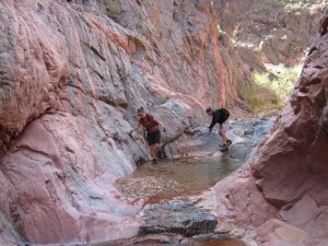 |
|
|||
|