Calaboose
| Route 66 | Cities | Beaches |
|
Calaboose |
|
| Auxier Ridge | Martins Fork | Grays Arch | Rush Creek | Pinchemtight | KoomerRidge | ChimneyTopCreek | ParchedCornCreek | SwiftCampCreek |
| IndianStaircase | Castle Arch | Osborne Bend | Raven Rock | Red Byrd Arch | Indian Creek | Revenuers Ridge | Copperas Falls |
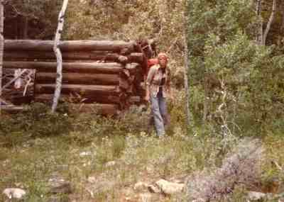
| The Calaboose is the wild, trailless, little visited easternmost sector of the Gorge. To get there, you hike down from Parched Corn Creek overlook on the Swift Camp Creek Trail. You wade Swift Camp Creek. Once on the far shore, you're in the Calaboose. You can also access it by parking at the Rock Bridge lot, hiking down to Rock Bridge, and walking across the stone arch (shown at right). Once on the far shore, you're in the Calaboose. Or you could exit the Mountain Parkway, drive into Wolfe County, and take the unpaved road out Calaboose Ridge to what used to be the town of Calaboose. Only a few people still live there. Most of the buildings have been removed, but there is a school, church and general store standing vacant and a few old cabins decaying (above right). However you get there, the Calaboose is a challenging terrain. Much of it is dense rhododendron thicket. Cliffs and rocky outcrops block your progress. A good topo map and a compass are necessities. | 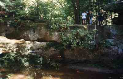 |
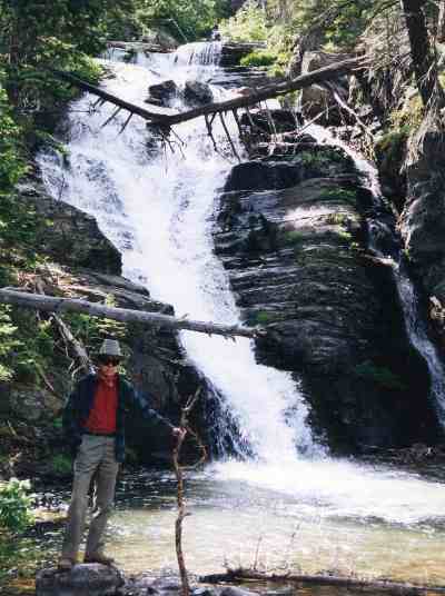 |
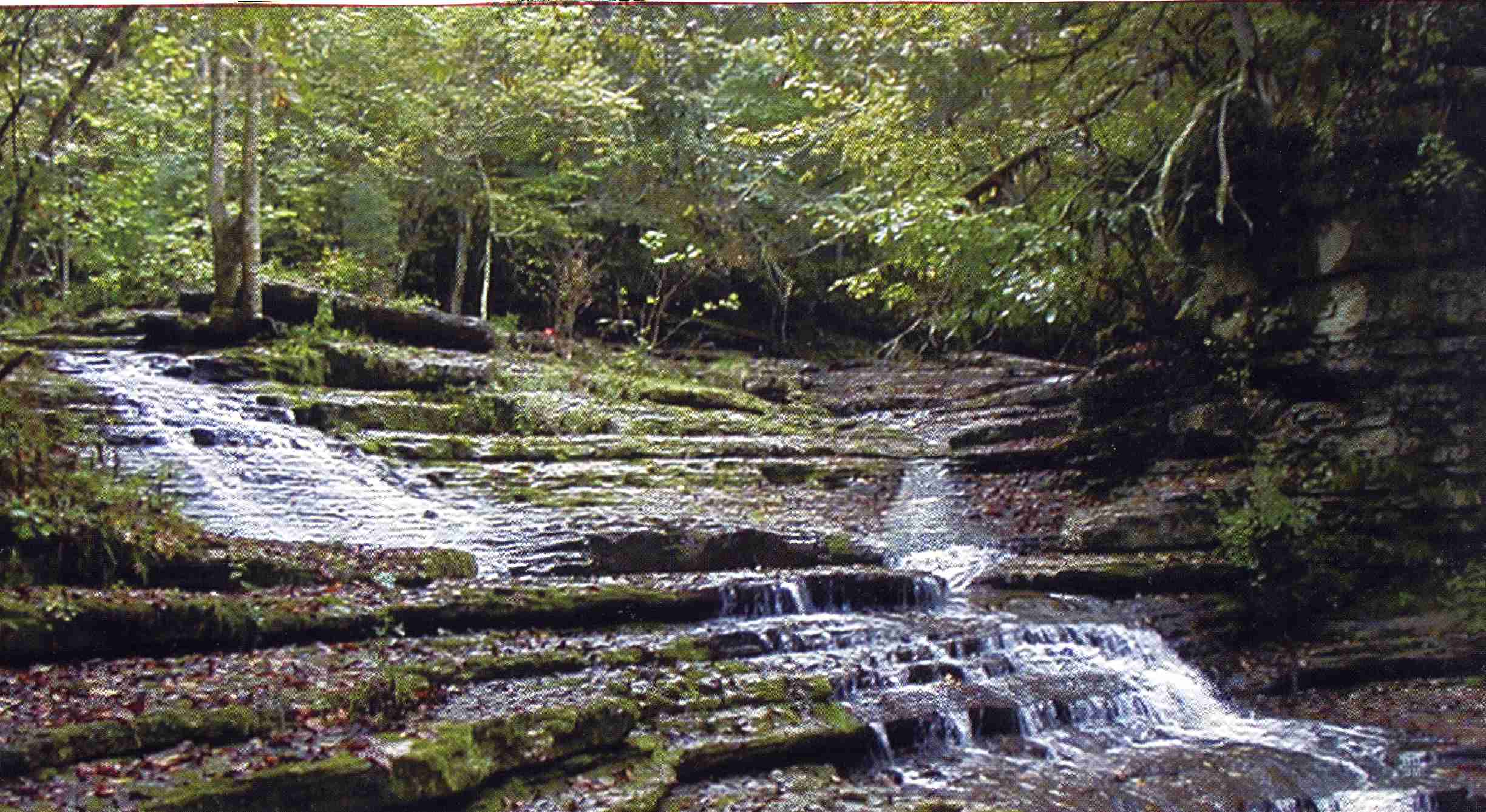
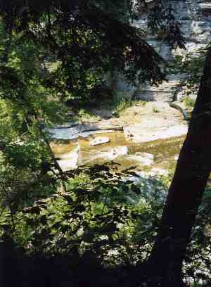
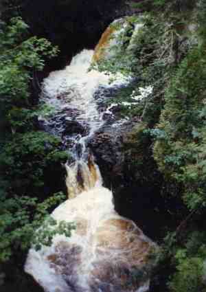
The Truth is, the Calaboose is not as scenic as other parts of the Gorge. There are not the spectacular arches or sheer cliffs, the haystack formations or giant boulders. There are a few smaller arches, but they're covered up by rhododendron or taller oaks and hemlocks. There is the Upper Red River Canyon, but even though the water is more treacherous the "river" is much narrower (it's more of a stream up here with 2/3 of its water siphoned off by Swift Camp Creek and Calaboose Creek) and the cliffs are not as high. Most of the "scenery" in The Calaboose is water, either cascading down stairsteps (top left) or over falls or sluices (left). But these are not along the main Upper Red. They're off on the side streams, sometimes where they empty into the Red, sometimes a mile bushwack up a side ravine. So if it's scenery you're after, you're better off down along the photogenic trails. You come to The Calaboose for a sense of adventure, to get off the established trails, to go where few have gone. Camping in The Calaboose is like camping in the Rockies : You have to hang your food between trees because you'll have bear in camp at night. You'll be awakened by the cry of a wildcat closing in on its kill. The tree cover is too thick for red tailed hawks so owls patrol the night. You'll see voles, deer and porcupine, and find tracks of raccoon, fox and possum. |
| The best experience in the Calaboose is a transect cutting all the way across, moving Southwest to Northeast from Calaboose Ridge to McCausey Ridge. It's a good place to practice your orienteering skills, although if you don't have any, The Calaboose is not the place to try them out for the first time. Your GPS unit will work in The Calaboose but your cell phone will not. We highly suggest having someone drop you off and pick you up, since leaving vehicles on either end can be risky. Do not bring a frame backpack. You'll be off trail, climbing and descending steep hillsides, struggling through rhododendron and blackberries, clambering over downed trees, scrambling over boulders (right). A frame pack will continually snag. You need a tall, narrow internal frame climber's pack. A good baseball cap works, but a broad brimmed Western style hat does not. | 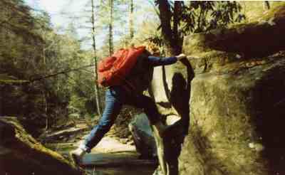 |
 |
One thing you won't need to carry a lot of in The Calaboose is water. As you can see from these pictures, there is plenty of water flowing everywhere. It's not very deep, and it's often inconvenient to get to, but it's there. You just have to scramble down rocks, steep banks or through rhododendron thickets. There may not be enough of it to canoe, kayak or swim, but there's plenty to drink or cook with. It's actually pretty clean, too. We've taken vials of it back to UK and had it tested, and there's no human or industrial contamination in it. You still have to purify it, because giardia lambdia is an occasional threat. But the water up in The Calaboose is purer than most of the water in Kentucky. Even with all this water, restrictions on fire building still apply. The streams tend to be flowing down in ravines, and up on the ridges everything is as dry as anywhere else. During times of adequate rainfall, however, there is plenty of firewood around, so you don't have to bring your stove and fuel. If you're bringing a group, a rope might be useful. You're continuously scrambling up and down hillsides, most of them pretty steep. Being able to loop a rope around a tree so everyone can use it as a climbing aid will speed your ascent and descent and, more importantly, reduce your impact on the environment. |
This is not a place for shorts. Kids will get their legs pretty scratched up and dirty without a good pair of jeans. It's also not a place for sneakers or "light hiking" shoes. Remember, there are no trails. None. So you'll be scrambling the whole day. Everyone needs a good pair of hiking boots. This is very definitely a place to keep groups together. Between the rhododendron thickets, boulders and steep terrain, you can't see very far. If two kids wander off on their own during a lunch break, you may spend the whole afternoon looking for them. It is very easy to get lost in The Calaboose. With no trail to follow, you can't find your way back to where you were 10 minutes ago. The sound of gurgling water muffles voices, and the ravines swallow them. Calling out to someone is usually futile. So if you're taking a youth group or your own kids out there, impress on everyone before you cross Swift Camp Creek that this has to be a group experience, not a day for individual forays. None of this means The Calaboose is especially dangerous or that you should avoid it. It's a great place and you ought to go. But it's not the casual walk in the woods the trails are. It requires a little preparation and some common sense. People have died out there, and people have gotten lost and had to have rescue parties go in and find them. Do Not Go Without A Topo Map, A Compass, And Experience In Using Them. You should also let someone know exactly where you're going and when you'll return. |
 |
|
|||
|